
Outstation route
Bangalore to Chamarajanagar: Distance and Cab
Chamarajanagar is Karnataka’s southernmost district, a green border region of forest, hill temples and quiet farmland. Here are the road figures from Bengaluru and how a private cab with a driver helps you cover the district.
The route
Distance and roads to Chamarajanagar
The route runs south-west from Bengaluru on the Mysuru highway and then bends south through country roads. Route planners list NH 275, NH 948, SH 33 and SH 81. Because several roads are involved, your driver’s local knowledge of the best connection on the day is useful.
| Road distance | About 165 km one way |
| Driving time (route planner) | About 2 h 45 min without traffic delays or stops |
| Main roads on the route | NH 275, NH 948, SH 33, SH 81 |
| Round trip | About 335 km of driving, plus any local sightseeing |
Measured from central Bengaluru (Vidhana Soudha) using OpenStreetMap route data. Your exact distance depends on the pickup point and the route the driver takes, and real journey times are usually longer once city traffic, ghat sections and breaks are added.
The time shown is driving time without traffic or stops. Compared with other places at similar distances, the stretch after the main highway is slower, with village crossings and narrower roads. Stay flexible on timing, and avoid planning tight connections at the other end. The trip is within Karnataka, so no interstate permit is needed.
Things to see
What the Chamarajanagar district offers
The district takes its name from Chamaraja Wodeyar, a ruler of the Mysore kingdom, and its reputation is mainly about forest and faith rather than city sights. Travellers usually use the town as a base for the surrounding region.
- Chamarajeshwara Temple in the town, a historic temple associated with the district’s name.
- Biligiriranga Swamy Temple Hills (BR Hills), a forest-covered range with a hill temple and a wildlife reserve.
- Male Mahadeshwara Hills, a major pilgrim centre covered on its own page.
- Forest country towards Bandipur and the rolling landscape around Gundlupet.
Forest areas have their own entry and safari arrangements which can change, so check current details before you plan a visit around them.
Plan your trip
Planning a longer day or overnight
At about 165 km one way, with a drive of nearly three hours, this is a long day if you want to see anything beyond the town. A same-day return is possible for a pilgrimage to a single temple, but an overnight stay lets you enjoy the hills without a late drive back through forest roads.
Pair it with the Male Mahadeshwara Hills trip, or travel on to Bandipur. Many travellers also stop at Mysuru on the way. If you want only a drop and will make your own way back, ask about a one way taxi.
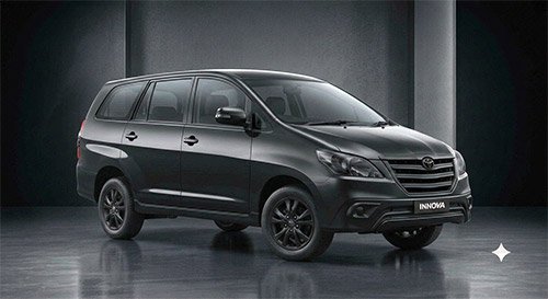
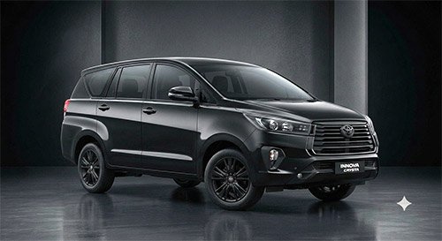
Round trips are billed with a minimum of 300 km per day, and the return journey here already goes past that, so billing follows the actual distance. Families with luggage will like an Innova or Crysta; a Tempo Traveller suits pilgrim groups.
Vehicle options
Cabs for Chamarajanagar
Vehicle availability depends on your travel date. Tell us your group size and luggage when booking and we will suggest a suitable option.




Tariff
Bangalore to Chamarajanagar: Distance and round-trip rates
| Vehicle | Round-trip rate | Driver allowance |
|---|---|---|
| Maruti Suzuki Dzire (sedan) | ₹14 / km | ₹350 |
| Toyota Etios (sedan) | ₹14 / km | ₹350 |
| Maruti Suzuki Ciaz (sedan) | ₹14 / km | ₹350 |
| Toyota Innova | ₹16 / km | ₹400 |
| Toyota Innova Crysta | ₹22 / km | ₹400 |
| Toyota Innova Hycross | ₹25 / km | ₹400 |
| Tempo Traveller | On request | ₹600 |
| Mini bus (21 / 24 seater) | On request | ₹600 |
Round trip, minimum 300 km per day. Fares are inclusive of GST, and the final bill is based on the actual distance travelled. Hill-station charges, interstate permits, state permits, tolls and parking are extra. One-way drop fares are confirmed when you book.
FAQs
Frequently asked questions
What is the Bangalore to Chamarajanagar distance?
It is about 165 km one way from central Bengaluru, which is about 2 h 45 min of driving without traffic or stops in route-planner data. A round trip is about 335 km.
Which highways does the route use?
Route planners list NH 275, NH 948, SH 33 and SH 81. The driver will choose the best combination on the day.
Is Chamarajanagar a day trip from Bangalore?
It can be done, especially for a single temple visit, but the drive is long. An overnight stay is more comfortable if you also want to visit BR Hills or Male Mahadeshwara Hills.
Is an interstate permit required?
No. Chamarajanagar is in Karnataka, though it lies near the Tamil Nadu border. Tolls and parking are extra.
How is a round trip billed?
Round trips are billed on actual kilometres with a minimum of 300 km per day, plus the driver allowance. The rate table on this page shows the structure, and the fare is confirmed when you book.
Explore more